A very civilized border crossing with the help of a young guy who probably wasn’t really necessary but who, by taking me from one counter to the next reduced the need for me to ask the obvious questions. My first destination was Tikal, only a short distance into Guatemala. A brief stop at a tiny roadside tienda for some eggs and some (very limited) vegetables took the locals by surprise but at least I had the makings of a meal for tonight if nothing else eventuated. The drive to Tikal took me around the edge of Lago de Petén and into impressive forests until, at the entrance to the ruins I found a very pleasant campground with the usual dysfunctional toilets and showers - but the location, on the edge of the ruins was perfect. Ocellated turkeys and various furry things scurried around the campsite.
 |
| Sunrise over Tikal |
 |
| An aracari - you guessed it, one of the toucan family |
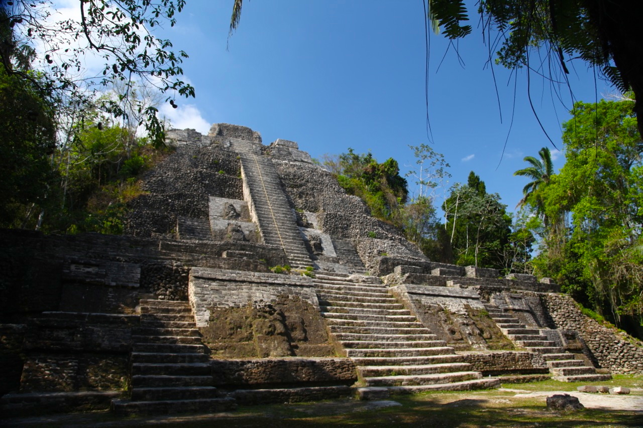
 The rest of the morning was spent exploring the remarkable remnants of this once great civilisation, and in the evening a walk through some more remote forest trails revealed lots of new birds. And then the clouds burst again, forcing me to retreat into some nearby ruins, fortunately with smoke-lined tunnels that enabled me to get in from the rain - shelter that I shared with bats and swallows as the light faded. A little later, he jabbering of spider monkeys heralded the end of the downpour, enabling me to make my way back to camp as darkness fell.
From Tikal, another relatively short drive took me to the little town of Flores nestled on a very pretty little island that floats off the shore of Lago (Lake) Petén Itzá. Half an hour would be sufficient to walk around it, but the numerous colorful cafes and restaurants are quiet enticing, so it ends up taking more like 2 hours. The consequence of this was that I was on the road to my next intended destination a little later than intended, and the roads, the ferry crossings and the gorgeous countryside not to mention (again) the dreaded topes, which have now changed their name to “tumulos” (but retain their impact on suspension) are not conducive to rushing.


As you head south from the lake, the flat lands start to undulate and the amount of vegetative cover increases (although all of it is second growth) until a row of limestone mountains looms ahead like a barrier. The dark cluds are building overhead, but the low evening sun sneaks through every now and then, lighting up a landscape of scattered fields and scattered villages. The houses here are simple, but charming (to someone who doesn’t have to live in them) - wooden slat walls with thatch roofs. In the sultry evening everyone is out on the streets. The women are all dressed in long, patterned, pleated skirts with a light, filamentous shawl over tops that seem not much more than lingerie - very practical given the humid conditions. The older men wear their cowboy hats and the young guys - yep - you guessed it - all wear baseball caps.
The sun is starting to drop by now and it is clear that I’m nowhere near where I intended to be by the end of today, so I’ve pulled down a gravel side road with a sign for a “Balnerio” or water park to find a beautiful little glade tucked in among the jungle-clad limestone ridges alongside a stream that emerged from a cave. The caretaker has told me that I can camp for the night - altho his price (by local standards) is ridiculous) but given the hour I’m not going to argue - and it is very nice. A pre-dinner swim and fire-flies yet again ended a very pleasant day.
 |
| Covered fern plantations - unfortunately they clear forest to grow them. |
After spending the first day wondering around the higher forest ridges in an unsuccessful search for quetzals, I heard that the best place to see them was in the garden of an adjoining little guest house, so I moved in there and, sure enough, over the next two morning got some great sightings, their colors flashing blue and green as they displayed in the morning sun.

 |
| Lousy picture but it is a quetzal! |
 After a "pankake" breakfast I hit the road, this time heading towards Huehuetanango. For the first couple of hours, the road was terrible and I ground slowly up hill and down dale, through steep sided valleys where excessive clearing on precarious mountainsides had resulted in many landslips and in one place, a massive landslide which, judging by the shrine with many names on in, must have taken a bus or a village with it. A massive afternoon downpour made driving impossible for an hour or so, but after waiting for it to pass, I made my way up a side road to the town of Nabaj - a medium sized town set in the mountains. A local balnario (water park) provided my accommodation for the night where I parked on the basketball court, adjacent to the paddling pools. People are incredibly helpful and accommodating and don’t seem to think anything of some crazy gringo rocking up and wanting a place to spend the night in his crazy car with a boat on the roof!

 |
| I'm guessing that the wet season may have arrived! |
 After breakfast and coffee by the swimming pools, I cycled into the centre of town where the markets were already in full swing. Navigated my way through the seething throngs of good-natured market goers. It’s easy to get a smile here and generally people are happy to have their photo taken, which is great given how colorful their attire is. A bit more cycling took me through the backstreets and into the surrounding countryside with a brief stop to watch a bit of local futbol, but unfortunately the standard wasn’t particularly high.


From Nabaj, I made my way towards Lago de Atitlan, a drive through largely cleared mountains but looking incredibly verdant as the scattered villages almost appeared to be sinking into the rapidly growing corn - an idyllic landscape at this time of year if you don’t look at it with the eyes of an ecologist. Again the afternoon clouds engulfed the mountains and it was only after a steep descent from Solala that I emerged to be confronted with the spectacular Lago de Atitlan, fringed by forest, steep cliffs and three volcanic peaks. A hotel by the waterfront had no guests, but did have spectacular views over the lake, and an area for camping, so I found myself with a million dollar view for what was a pricy 150 Quetzales ($15) but what the heck, this is said to be one of the most beautiful lakes in the world and I'm not arguing.


My next destination was the ancient city of Anigua Guatemala, once the capital of the country but a devastating earthquake laid much of it to waste and the capital was relocated. Antigua however has rebuilt itself as a very pleasant little cultural capital, with lots of nice cafes and restaurants and stunning views to the mountains and volcanoes that surround it.


 |
| Cultural contrast! |
The smoking Volcano Pacaya was my next destination where a local "guide" offered to take me up the back way, so we proceeded to poke along back roads through little villages until we were confronted by the lava and scree slopes of the volcano. Some low range 4x4 crawling took us further up the mountain (I’m impressed by what this truck can do) until we could go no further, after which we scrambled upwards on foot over the loose black, honeycomb textured rocks which gave way under our feet, sending rocks tumbling down the slopes below. Clearly this was a very young landscape, with a few lichens and plants taking the first steps towards what would, if left to its own devices, ultimately become a jungle-clad slope if only we humans were to let nature take its course, which is highly unlikely to happen.


After scrambing around on the slopes, with smoke belching above and the occasional rumble from the volcano we headed back down to explore more little villages and a nearby lake before I set off westwards to once again reacquaint myself with the not very peaceful Pacific. On this occasion, the large dumping waves crashed on the black sand beach of Monterico, Guatemala’s attempt at a beach resort strip - all very low key with only a few visitors around to support way too many restaurants and hotels. I had decided to stay in a hotel here, thinking to indulge, but the place I stayed, supposedly one of the more popular with over-landers, had way more staff than guests. Passed a pleasant evening chatting with Tony, an Irish/Scotsman who had spent the last 20 years in Guatemala and was helping to manage this hotel, alternating between Lago de Amatlan and Monterico. He mad the interesting observation that even paradise becomes boring if you are there too long and, as a consequence he was looking to move on - an interesting observation given how enticing somewhere like Guatemala could be to anyone looking for a new place to spend some time.
I decided to take the back way out of Monterico to get to the San Salvador border but the road just took me to the edge of a mangrove-lined river. So, what do you suspect they use barges like this for?

Obviously to overload with vehicles! But, the locals seemed to think it was safe so.....

...with much creaking and groaning I inched aboard.

I thought that I was just crossing the river but the next thing I knew we were heading inland through the mangroves, hoping fervently that the destination was close enough to be reached before the rapidly inflowing water became a problem!


After about two kilometers we finally came ashore, where I inched off once again to the sound of splitting timbers and waved goodbye to the boatmen as they bailed out the water, and farewell to Guatemala as, shortly afterwards I crossed into El Salvador.
I'm not sure why Guatemala had never found its way on to my radar before, but it is truly an amazing country - one which I will happily return to.